Home > Arts > Artists > R > Roman Roman
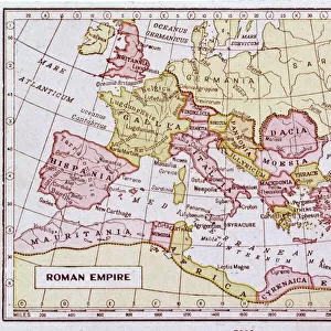
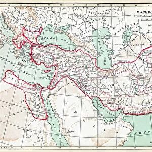
Map of the Dacian Empire and Roman provinces

![]()
Wall Art and Photo Gifts from Mary Evans Picture Library
Map of the Dacian Empire and Roman provinces
Map of the Dacian Empire and Roman provinces. Date: 1801
Mary Evans Picture Library makes available wonderful images created for people to enjoy over the centuries
Media ID 11575343
© Mary Evans / Grenville Collins Postcard Collection
1801 Adriatic Balkan Balkans Chart Dacia Dacian Dalmatia Dalmatian Danube Illyria Illyrians Macedonia Maps Region Serbia Serbian Slavic Yugoslavia Dobrogea Pannonia
FEATURES IN THESE COLLECTIONS
> Arts
> Artists
> R
> Roman Roman
> Arts
> Landscape paintings
> Waterfall and river artworks
> River artworks
> Europe
> Macedonia
> Posters
> Europe
> Macedonia
> Related Images
> Europe
> Related Images
> Europe
> Serbia
> Related Images
MADE IN THE USA
Safe Shipping with 30 Day Money Back Guarantee
FREE PERSONALISATION*
We are proud to offer a range of customisation features including Personalised Captions, Color Filters and Picture Zoom Tools
SECURE PAYMENTS
We happily accept a wide range of payment options so you can pay for the things you need in the way that is most convenient for you
* Options may vary by product and licensing agreement. Zoomed Pictures can be adjusted in the Cart.