Home > Europe > France > Canton > Landes
True-colour satellite image of Ulster, Ireland

![]()
Wall Art and Photo Gifts from Science Photo Library
True-colour satellite image of Ulster, Ireland
Northern Ireland. Satellite image of Northern Ireland, also known as Ulster. The colours approximate to natural tones. North is at top. The capital of the province, Belfast, is at right, whilst the city of Londonderry is at upper centre. The largest lake in the British Isles, Lough Neagh, is at centre right. Lough Foyle (at top centre) and Strangford Lough (at far right) are two sea inlets which are almost totally enclosed by land. Image taken by the American Landsat-5 satellite
Science Photo Library features Science and Medical images including photos and illustrations
Media ID 6349601
© PLANETOBSERVER/SCIENCE PHOTO LIBRARY
British Isles Earth Science From Space Great Ireland Landsat 5 Imagery Northern Ireland Sciences Belfast Lough Neagh Ulster
FEATURES IN THESE COLLECTIONS
> Europe
> France
> Canton
> Landes
> Europe
> Republic of Ireland
> Lakes
> Related Images
> Europe
> United Kingdom
> Lakes
> Related Images
> Europe
> United Kingdom
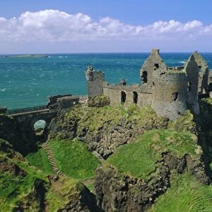
> Northern Ireland
> Belfast
> Europe
> United Kingdom
> Northern Ireland
> Lakes
> Europe
> United Kingdom
> Northern Ireland
> Londonderry
> Europe
> United Kingdom
> Northern Ireland
> Posters
> Europe
> United Kingdom
> Northern Ireland
> Related Images
> Europe
> United Kingdom
> Related Images
> North America
> Related Images
EDITORS COMMENTS
This stunning true-colour satellite image captures the breathtaking beauty of Ulster, also known as Northern Ireland. The vibrant colours in this print closely resemble the natural tones found in this picturesque region. With the north positioned at the top, you can easily identify Belfast, the capital city of Ulster, on the right-hand side of the image. Moving towards the upper centre, Londonderry emerges as another prominent city within this landscape. As your eyes explore further, you'll notice Lough Neagh taking center stage - a magnificent lake that proudly holds the title of being the largest in all of Britain and Ireland. Atop lies Lough Foyle and to its right is Strangford Lough; both sea inlets are almost entirely surrounded by land, creating an enchanting sight. Captured by America's Landsat-5 satellite, this remarkable photograph showcases not only Northern Ireland's awe-inspiring geography but also highlights its significance within Great Britain and beyond. It serves as a reminder of Earth's extraordinary wonders seen from space.
MADE IN THE USA
Safe Shipping with 30 Day Money Back Guarantee
FREE PERSONALISATION*
We are proud to offer a range of customisation features including Personalised Captions, Color Filters and Picture Zoom Tools
SECURE PAYMENTS
We happily accept a wide range of payment options so you can pay for the things you need in the way that is most convenient for you
* Options may vary by product and licensing agreement. Zoomed Pictures can be adjusted in the Cart.